
by Leah Glass, Blue Carbon Project Manager, Madagascar
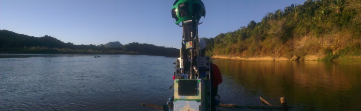
I’m writing this blog whilst drifting down the Sambirano River in northwest Madagascar on a traditional pirogue. On a ‘normal’ work day I’d be on my way to visit one of mangrove communities that we work with. But today I’m not working on a ‘normal’ BV project (if such a thing exists).
Crossing a river and entertaining local children in northern Madagascar
If you live in Europe, the Americas or Australasia, you may have seen the Google Street View cars, with their large globe cameras on the roof, driving around your neighbourhood capturing imagery for upload to Street View. But countries that lack decent road infrastructure are often not covered by Street View. Madagascar is one such country. To rectify this situation, Google have partnered with Blue Ventures to bring Street View to Madagascar, though it’s Google Trekker campaign. However, no cars are involved; we’re carrying the massive camera around on our backs, using a specially adapted 20kg backpack! And today we’re capturing the beautiful Sambirano for the rest of the world to see from the relative comfort of their desks.
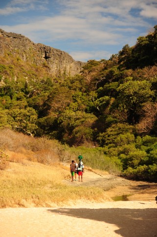
Trekking through the beautiful landscape of Nosy Hara
For Blue Ventures this is a fantastic opportunity to put some of the remote and beautiful places in which we work on the most viewed map in the world. As well as capturing our project sites, we’ve also partnered with Madagascar National Parks to trek in some of the country’s most spectacular parks. We’ve trekked all over Madagascar, from the mangroves, tropical islands and archipelagos of the northwest, through the magnificent Ankarana and Andringitra National Parks, all the way down to the spiny forests and remote fishing villages of the southwest.
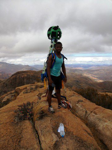
On top of the world in the Andringitra region
But it’s not all fun and games. Before we even put the camera on our backs, the logistics of lugging 100kg of camera gear around some of the most rural parts of Madagascar is a challenge in itself. So far the trekker has travelled by sailing pirogue along remote coastlines, by motorboat across very choppy open water, in a 4×4 over 100’s of kilometres of narrow sandy tracks and even by zebu cart…
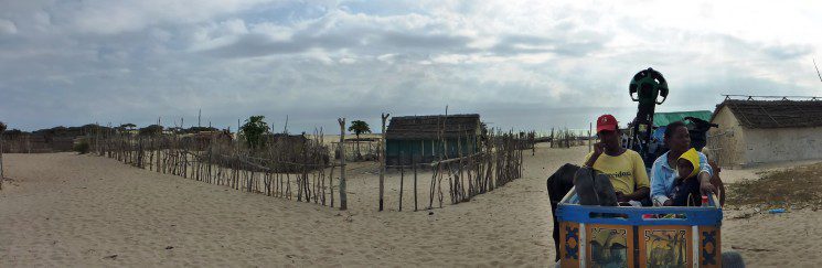
The Trekker getting some well-deserved rest on a zebu cart
The extremely long, bumpy and wet boat ride from the Nosy Hara archipelago to the mainland was probably the most extreme to-date. Various other pieces of electronic equipment didn’t survive the crossing, but the Trekker walked away unscathed, though smelling distinctly of fish!
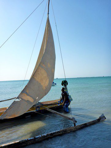
Travelling by sailing pirogue near Andavadoaka
The Trekker heads back to Google headquarters in California next month, where the data will be processed and uploaded to Street View early next year. So if you put Sambirano River into the search bar of Google Maps in a few months time, you may very well see me writing this post on my tablet, in between turns of helping to paddle the pirogue!
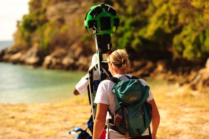
It’s hot work carrying the Trekker!