
How local expertise and data-driven conservation are reviving octopus fisheries in Ende, Indonesia
Arya Dhani joined Blue Ventures in November 2022 as a Fisheries and Data Technician in Indonesia. Arya uses his fisheries management expertise to provide technical support to Blue Ventures partners in Indonesia, particularly focused on fisheries data collection and data analysis. Here he talks about his recent activities in providing technical support to the Tananua Flores Foundation to conduct coral reef monitoring to optimise the octopus fishery management being carried out in Ende, East Nusa Tenggara, Indonesia.
Situated along the coastline of Flores Island, Ende is where unusual volcanic landscapes harmoniously blend with stunning seascapes. Being part of the Coral Triangle, Ende boasts an abundance of coral reef ecosystems, which serve as habitats for a multitude of species. It holds significance as one of the central hubs for octopus fisheries in Indonesia.
Fishers in Arubara Hamlet and Maurongga Village have spent the last months strengthening their monitoring and data skills, so they can implement restorative closures to allow habitats the space to recover.
We are working with Tananua Flores to support sustainable small-scale octopus fishers in Ende. To further safeguard the fishing grounds, Tananua Flores and the Branch Office of the Marine Affairs and Fisheries Agency of East Nusa Tenggara Province are working together to establish a Marine Protected Area (MPA) covering the waters in Ende, Nagekeo, and Ngada Regencies, to protect crucial habitats for fish.
Traditional fishers and local authorities in Maurongga have decided to apply temporary closures in several fishing grounds for three months. The areas will be reopened for a few weeks, allowing shared use by its residents. This strategy aligns with Locally Managed Marine Area (LMMA) principles, which empower communities to manage marine areas for livelihoods and conservation purposes. However, it requires strong support from reliable data and information.
In March, 30 participants joined a reef monitoring training. They received new information and skills on coral reef ecosystems, monitoring processes, and data collection techniques. The sessions employed a participatory learning approach, accommodating the existing values and wisdom in the communities.
“It benefits not only the community but also the staff of Tananua,” said Pius Jodho, the Marine Program Manager of Tananua Flores. “By understanding the functions, types, and threats to the coral reef ecosystem, the community can take decisive action to protect it. They can conduct coral reef monitoring independently in the future, inspiring peers in other villages to follow,” he added.
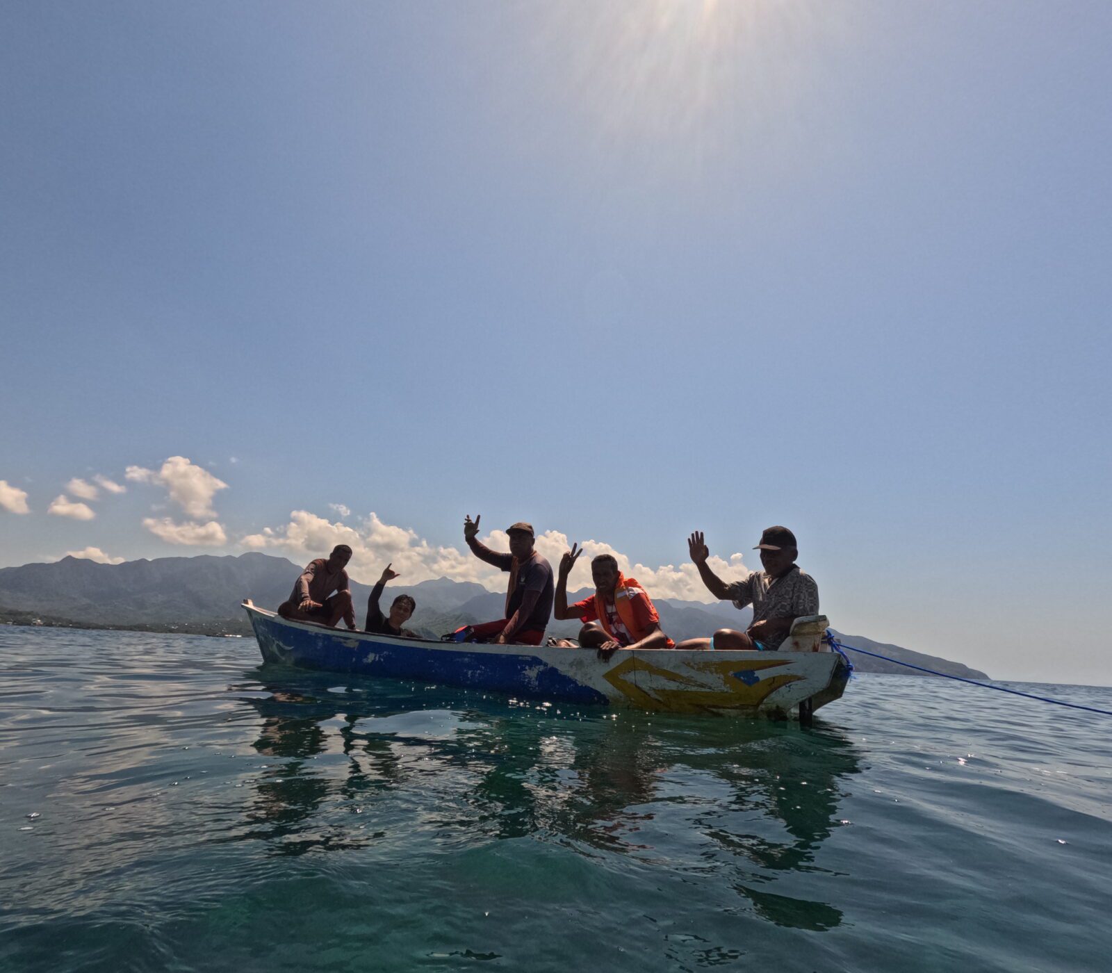
To observe the condition of coral reefs, participants used a simple method called Manta Tow. By holding on to a manta-shaped board tied to the rear part of a boat, which moves at a constant low speed, they can directly assess the distribution of live coral cover and various growth forms underwater. “I just learned that coral reefs are animals; I used to think they were plants,” expressed Fudin Ali, an octopus fisher and collector from Arubara at the Manta Tow session.
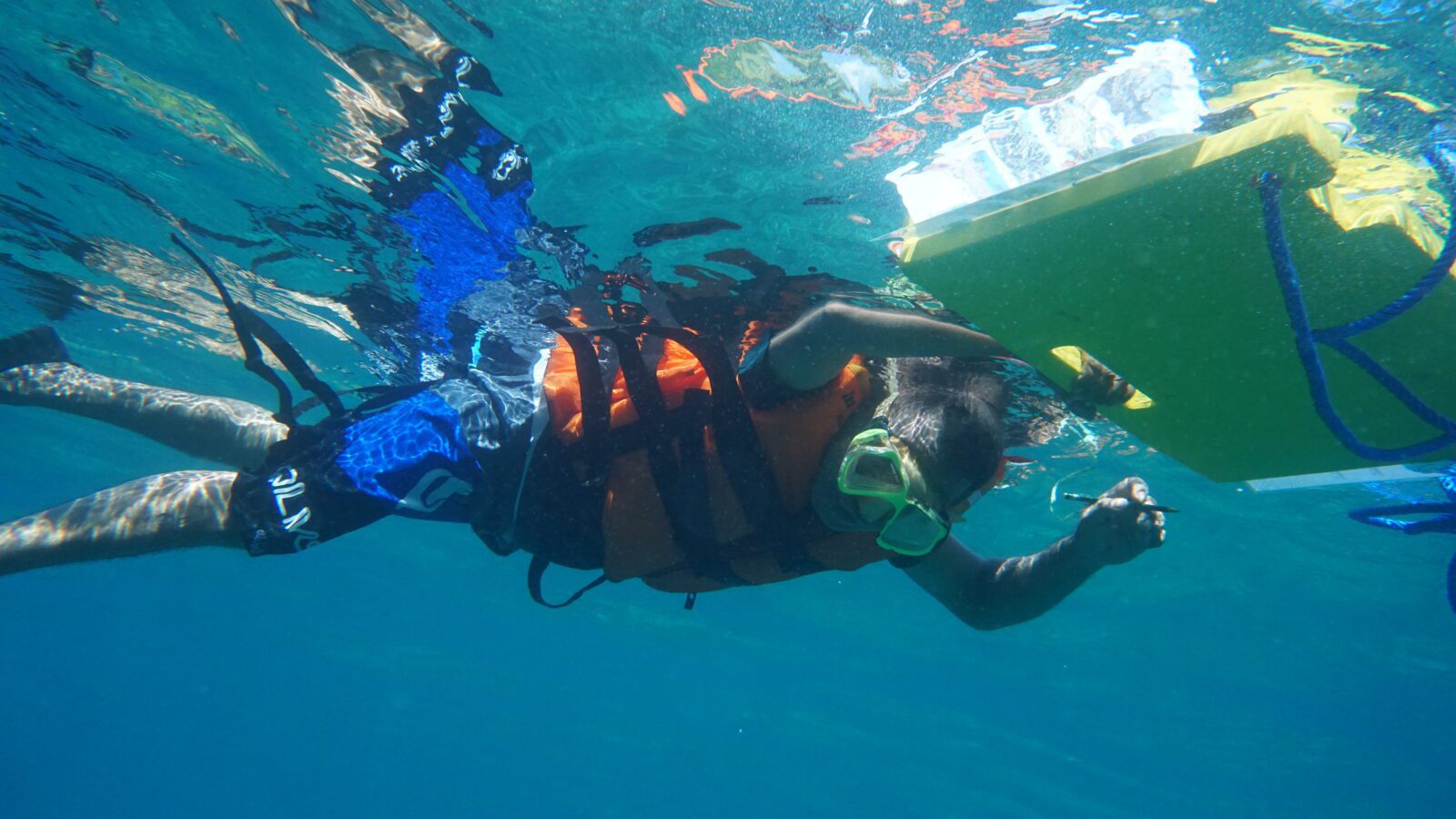
The observer during Manta Tow operations
Observations in Arubara and Maurongga totaled 42 towing sessions, covering a distance of more than 5,500 metres. They eagerly carried out each towing session, spanning around 100-150 metres or roughly five minutes.
Upon the boat’s halt, observers took a moment to rest by floating on the water’s surface and recorded their observations alongside the recorders. Occasionally, friendly discussions and lighthearted exchanges arose when observers encountered challenges in determining the average percentage of live coral. Thankfully, the day enjoyed sunny weather and clear seawater, allowing observations to extend to depths of over eight metres.
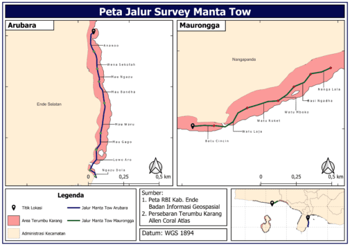
Map of Manta Tow Survey Routes in Arubara Hamlet, and Maurongga Village
During the training sessions, participants also learned essential techniques such as teamwork and formation, understanding the required equipment, designing monitoring routes, comprehending the types of data collected, and conducting direct field practice to gather data. The field data collection practice was divided into three groups, all following the same monitoring routes, to observe variations in observation accuracy.
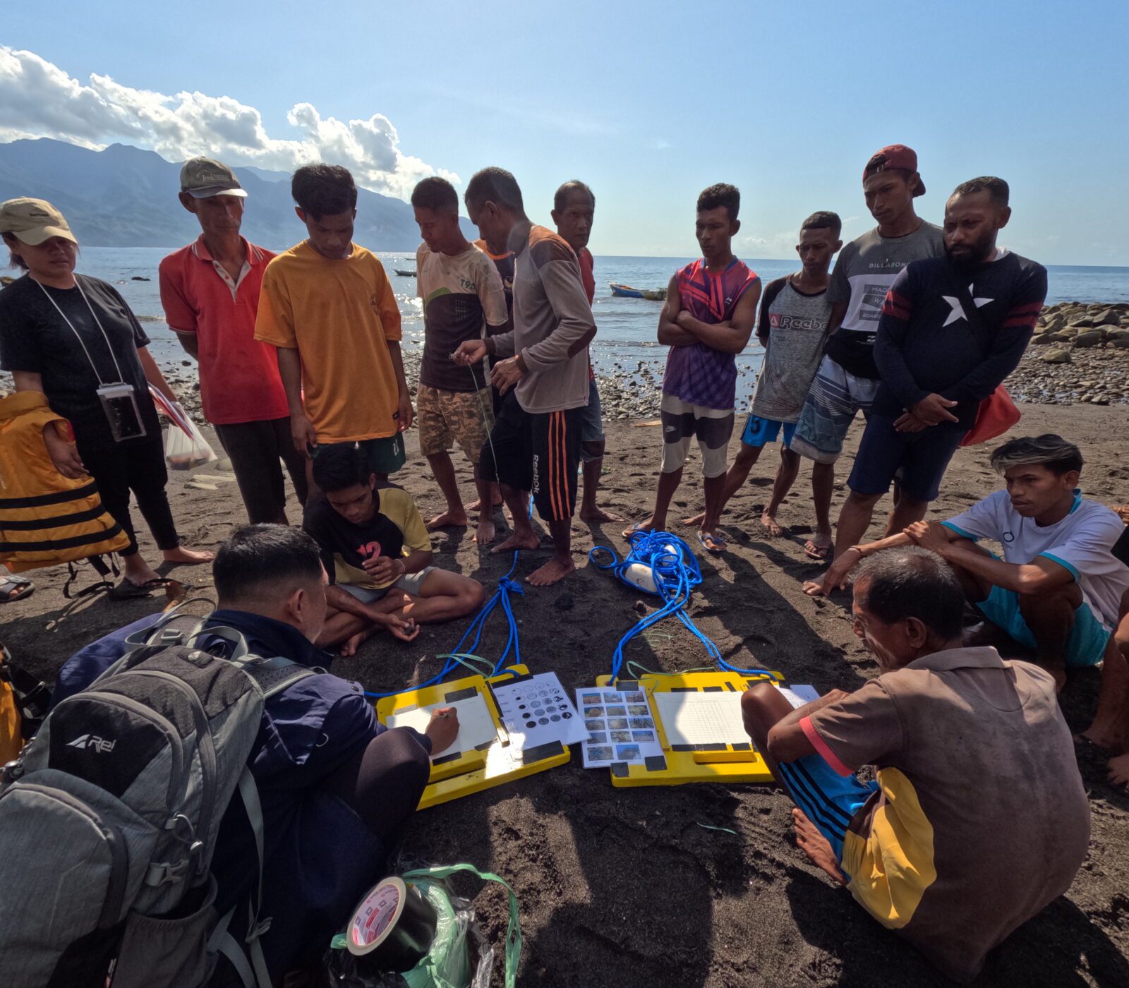
Equipment preparation and instructions for the trainees
Each group had assigned roles, including a team leader, driver, recorder, and observer. The team leaders instructed the drivers regarding the monitoring routes, timing, and coordinates of the observation locations. The recorders documented the coordinates and names of the sites. The observers observed the coral reefs and recorded the findings on waterproof paper. Each group member took turns assuming these roles. Subsequently, each group conducted a presentation to showcase their observation findings.
The coral reef monitoring at these sites showed a low percentage of live coral cover. In Arubara, the live coral cover percentage was 23.75%, while in Maurongga, it was only 19.6%. Participants suspected destructive fishing practices in the past and active sedimentation from the mainland have contributed to the adverse circumstances. As both results fell under the poor category, it was clear that the closure of the area is essential to allow coral recovery for an ideal habitat for octopuses.
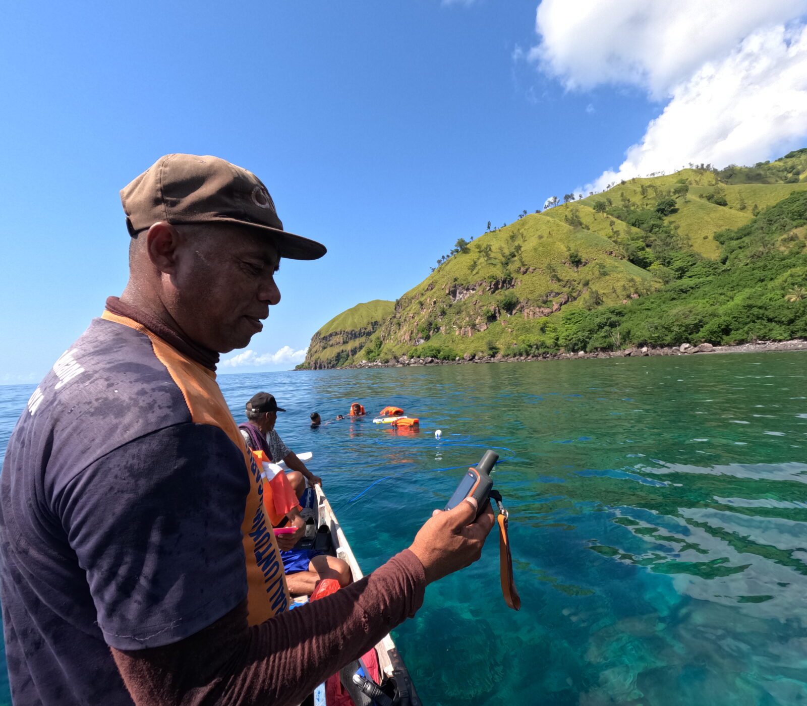
The participants took coordinate points and recorded observation point information
In the discussion and presentation, participants also acknowledged challenges in remembering the types of coral substrates and the forms of coral growth. Nevertheless, they were confident that with the use of guide cards over time, they would eventually be able to recall and understand the information covered in the classroom. The pre-and post-training assessment results also showed increased knowledge of the participants.
Upon completing the training, the team proceeded with data collection to assess the status of the coral reef ecosystem in the temporary closure locations in Arubara and Maurongga. Only a few representatives of the participants were involved in this activity, chosen based on their capabilities and enthusiasm. The number of teams adjusted the capacity of available boats.
Manta Tow team shot
Through exercises and data gatherings, the community can confidently identify suitable locations for temporary closure based on optimal octopus habitat. They can compare the multitemporal coral reef data with daily octopus catches from the fishers to reveal patterns, trends, and impacts from the temporary closures. It will enable the community to make sound and well-informed decisions about sustainable fisheries management in their villages, particularly on octopus.
Effective management will protect coral reef ecosystems, ensuring the long-term well-being of the fishing communities in Ende.